Chapter 3 Further Exploration Essential
3.1 Discovery Club:
Defying gravity; revising plans.
"Traffic Tyabb, Cessna 310 November X-ray Alpha is taxiing runway 35 for local flight."
Pilot Mal pushed hard and held down the left rudder toe brake, and simultaneously pushed forward the right throttle slowly. The aircraft moved forwards and started to turn left. Then it was on the taxiing path, turning left and slowly trundling towards the take-off area of 35 degrees north.
Mal had carried out all the obligatory pre-flight checks. He had checked for water in the petrol; twisted the steering yoke to see if the ailerons were free and easy; checked all instruments, including the radio, and had run up both the engines separately three times to the maximum engine rpm and manifold pressures.
Mal had rung Phill to say that he was flying the plane to Launceston the next day and wanted a bit of additional weight on a small checkout flight, before flying over Bass Strait.
"Traffic Tyabb, November X-ray Alpha, departing 27 for local flight."
Mal eased forward the engine throttle, slowly letting off the toe brakes. Within 20 metres the plane started to accelerate madly; at 100 metres Mal pulled the nose up gently to unstick the nose wheel from ground effects. By now both engines were screaming at full power. The pilot's stubby finger touched several dials as he mumbled a final vital checklist, deciding whether to abort or continue the take off. With a gentle pulling back on the controls to no more than 15 degrees, the plane flung itself into the air. Take-off speed was 95 knots or 176 kilometres per hour.
Rapidly a height of 500 feet was achieved, whereupon Mal rolled the plane to the right, still climbing at a good rate. At 1000 feet Mal scanned the sky, then rolled to the right. At this point the plane was flying exactly in the opposite direction to take off with the strip to the right-hand side. Halfway down the strip, Mal again rolled to the right and crossed the runway at 2000 feet.
"Well, how was that, fellows?"
All Chris could say from the back seat was, "Great."
Out over the Peninsula area, after listening to the radio to hear if anyone was in the immediate vicinity, and scanning the sky carefully to see if any other plane was present, Mal banked the plane to 60 degrees and carried out a rate 60-degree turn in the prescribed two minutes, without losing height. The plane bucked a little when it hit its own wash at the precise point of departure. Perfect control! All persons in the plane suffered the usual tummy, mouth, head drag confusing gravity.
Now for a speed trial, flat to the boards. Scorching over the ground at 197 knots, or 365 kph. Wow!
Time to finish the flight, after turning back towards the Tyabb airfield, a 180-degree view on offer. To the right Portsea back beaches and Bass Strait, Flinders, Phillip Island, the wind farm at Wonthaggi, French Island and beyond, the power stations at Yallourn, Mount Baw Baw, and of course Westernport with all its inlets and towns. the plane flew over the perimeter airfield fence at 110 knots, or 203 kph, nose lightly pulled up, beaut flare, then settled to slow down along the strip. At the aviation petrol bowser, a lengthy and expensive refuel took place. The plane taxied back to the parking area. Exercise over.
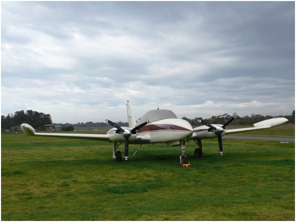
The Cessna 310 at rest at Tyabb airfield
Later that afternoon at Phill's place, Tristan grasped the plastic ruler with his left hand, held the rubber onto the top with the fingers of his right hand, bent back the ruler like a shanghai and was about to flick a stinging missile at Chris, who was at the opposite end of the dining-room table.
"Cut that out, dill brain," growled Phill. "We are not at school."
Both Tristan and Chris were at their most mischievous best, full of humour.
Disappointment in being unable to take out Tom Thumb junior to continue the survey of Hastings bight, and Kings creek in particular because of the very gusty 30 to 40 knot northerly wind, all the guys went to the local golf driving range and for a couple of hours to hit golf balls all over the range. After about 20 balls each with another 60 to go, the popular idea became: " See if we can hit them over the shopping centre fence."' Quite impossible really.
Back home they hopped into kransky sausage in rolls, a couple of shish kabobs with some salad followed by ice-cream-just what the doctor ordered.
A short time later, Chris was drawing lines on the map, linking Tyabb airfield to Bendigo and Warracknabeal, to Hamilton and Portland. Tristan had previously drawn on his map Tyabb airfield to Mallacoota to Albury to Shepparton to Seymour to Tyabb. Both were using Phill's WAC charts-World Aeronautical Charts that all pilots use to get from here to there.
The objective was to get used to plotting on a chart, how to get to a destination and preparation for flying to the east coast of Victoria, where George Bass commenced exploration in his voyage to Westernport. It was necessary to do the same in the western part of Victoria, particularly the Cape where James Grant in the Lady Nelson had found the coast and started viewing and surveying previously unexplored land prior to sailing through Bass Strait.
The information was a little difficult to absorb, thus the need for humour. The trick was to understand that all maps are oriented to point to true north. However, all compasses point to magnetic north. Magnetic north is that part of the Earth close to the North Pole that slowly changes its location, so it is necessary to subtract or add a few degrees to compensate when sailing or flying.
When the fellows fly from Tyabb airfield to Cape Howe on the south-east NSW-Victoria border to retrace Bass's sailing, and to Cape Northumberland in SA, near the Victorian border, to retrace Grant's sailing, a bit of head scratching and mumbling should prevent them getting lost.
In general discussion they all realised that to explore what Bass, Francis Barrallier, Murray, Brevedent and the soldier's son had visited, they in turn needed to explore, survey and draw a number of places: Quail Island, Warneet to Lang Lang, Redbill creek, Corinella surrounds, Elizabeth Island, Bass River, Rhyll, Churchill Island, Seal Rocks, Sandy Point, Sandstone Island and Tortoise Head. Another objective was to locate the fresh water stream on Phillip Island that Lieutenant Murray found and signposted. The fellows would have to determine what was feasible.
Previous Chapter | Chapter Selection | Next Chapter | Download Chapter