Chapter 1 Westernport
1.5 Diary of Geo. Bass:
Sailing to Westernport
3rd December 1797
Nearly twelve months ago three sailors arrived in Port Jackson, after some fishermen had found them eight miles south of Botany Bay. They had been shipwrecked on an island near Van Diemen's Land on their way from Calcutta India, to Sydney town with many types of stores that the colony could use.
Seventeen men had taken the ship's longboat and sailed in a northerly direction, landed probably west of Rams Head and had walked about 500 miles in a northerly direction to Port Jackson. Only three survived that far.
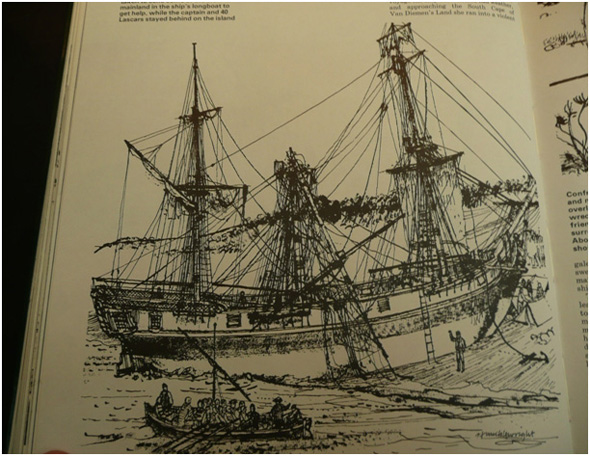
Wreck of the Sydney Cove. SLV.
The Governor sent me with Mr Clarke-a survivor-and a small whaleboat crew a few miles south to see if we could find any other survivors. We only found a few bodily remains. I was able to confirm to the Governor that Mr Clarke did actually burn lumps of coal to keep warm, and large seams of coal were present in the cliff faces. This news was of extreme importance to the Colony. It could be mined and used for a variety of purposes, and also reduce the cost to the government of maintaining the Colony.
Governor Hunter told me that when the refitting of HMS Reliance was completed in about a month's time he would send Matt Flinders with HM schooner Francis on her third rescue trip to the island [now called Providence Island in the Furneaux group]. They were to rescue any remaining shipwrecked sailors from that ship Sydney Cove, and as much of the remaining stores as possible .
Matt was not in charge, but he was to carry out some surveying and map drawing to help future voyagers. If anyone could do that in a superb manner Matty could. He learnt a great deal of seamanship, navigating, surveying and map creation from Captain Bligh and others. Captain Bligh was a midshipman on one of Captain Cook's voyages.
The shipwreck event further encouraged Governor Hunter to pursue the idea of deciding if a strait of water existed between Van Diemen's Land and N.S.W.
In our preparations we stowed enough water casks, ship's biscuits, salt pork, onions, portable soup, and mash of peas, corn and wheat for six weeks. With cooking utensils. We took some salt to preserve fresh fish and meat. Our fishing gear and muskets would surely add to our rations. We had to fit in some repair tools, spare canvas and rope for the whaleboat rigging, bailing canvas buckets, and canvas cover alls to try and protect us from the rain, heavy seas and sun. Great care was needed when stowing the boat. We only had a two-foot keel depth.
I had studied sailing and navigation in England and had practised it with Matty on the voyage from England. I was able to take a copy of Cook's map of the coast, a compass, quadrant, lead line, a small amount of writing paper and lead pens to map and fill my daily journal.
Our course would be S.S.E., sailing into the prevailing winds from the south on long reaches. Providing we did not get blown too far offshore all we had to do was follow Cook's map and his drawings of physical features of the coast. When we got further south than Captain Cook had reached after exploring New Zealand, we would sail west and hope to follow the coast on our starboard.
None of the naval Captains after Captain Cook had time to explore the coast. That is our aim. The voyage would also prove if there was a strait between N.S.W. and Van Diemen's Land.
On the way down it was good to be able to point out to my people where Matt, my servant and I had sailed my little 10-foot dinghy Tom Thumb to Watta Moulla. Also later where we sailed a bigger Tom Thumb to a lagoon, near Hat Hill that the local Indians called Illa Warra, about 60 miles south of Sydney.
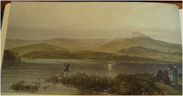
Tom Thumb Lagoon, Illa Warra. SLV.
Previous Chapter | Chapter Selection | Next Chapter | Download Chapter