Chapter 4 Extending Our Understanding
4.1 Drive around the Port:
HMAS Cerberus, Cape Schanck and Sorrento.
What would the anchorage spots have looked like to the early discoverers about 200 years ago? That was what today's fun was all about. How would the early explorers have managed their old-fashioned sailing boats, in anchoring? Simply staying out of harm's way!
Fortunately, or unfortunately, it was a typical Mornington Peninsula grim winter's day with air temperature an expected top of 14 degrees. There were gale warnings for east of Cape Otway to Wilsons Promontory. The forecast was for severe wind squalls from the NNW in the morning, changing to the SW in the afternoon, possibly abating a little. Frequent showers, with the occasional bucketing down of rain.
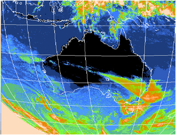
Satellite image showing weather activity over Victoria and Tasmania
It was a perfect day to visit most of the sites that Bass, Grant, Barrallier, Murray, Milius and Brevedent would have seen and experienced. How much had changed since then? One thing was sure though, none of them would be silly enough to be in this part of Australia Felix at this time of the year. Even Commander Hamelin, the other captain of the French expedition, who left Port Jackson in May for Mauritius, thinking that Commander Baudin and crew had sunk, had to turn back because of bad weather.
"Up you go, Chris, open the cabin and find a good Westernport map," Phill suggested.
The fellows were at the Yaringa marina at the start of the day. Phill's boat was in the stocks being anti-fouled.
"Hey, Phill, that's a big boat." Tristan pointed to a gigantic cruiser.
"Yep! Millionaire, hey? But look over there." Phill indicated a smallish Couta boat that was being lovingly painted. It gleamed in the weak occasional sunlight. That was a real explorer's size, about 9 metres.
Tristan surveyed the boat. "That boat has some decking, weren't the whalers and other ship's boats just open?"
"Yes, every bit of wind, wave, rain, spray, sun hit you in the boat, unless you were lying in the bottom covered up with a bit canvas."
"How about this map?" Chris climbed down and opened up the map. "Is there a boat here the same size as the Lady Nelson?"
"I don't think so but we can have a look," replied Phill.
At this stage it was impossible to see past Barrallier Island to the east, because of the weather. They could not see the distant shore of Lang Lang. However, it did not stop the fellows taking a rough directional bearing of Lang Lang and finger-drawing the direction on the map. Using the toes of their runners and making lines in the gravel, as well as horsing around, they practised making a sailing direction, showed the current wind direction, then decided which way the ship would have to sail to use the wind.
It soon became apparent that you would have to be crazy sailing a 50-tonne sailing boat without an iron sail (engine) in this part of the Port. What with the limited ability to sail into the wind, not like modern yachts, the force of the wind, and the prevalence of mud banks that we know about.
It was time to get a move on, they planned to visit lots of places. They would drive in a clockwise direction, and the western part of the Port would have to wait until another day.
The fellows only just saw the tower at Lang Lang in the gusty rain, nearly missing the highway turnoff into a little gravel lane on the right. It was hopeless trying to get to the tower, as the track was covered with sheets of water for some distance. Luckily the road to the beach area, caravan park and boat ramp a few clicks further down the highway was clear.
As they drove slowly down the road, the high waves crashing onto the beach and rock foreshore became apparent. Sometimes the spray reached about two metres. Getting out of the Discovery into the rain and wind, with the map and binoculars was not all that pleasant. With lots of muttering and complaining, none of them could see any channel markers at all. This was one objective they had set.
"I know there are some out in that direction," said Tristan, flapping an arm towards the west.
Chris pointed northwards through the heavy rain. "There is the tower, so according to the map some poles must be out there. Anyway, I can't even see Barrallier Island, I can just see the tip of French Island."
Fortunately the map was sheathed in plastic so the rain just fell off, but all the fellows dived for the comfort of the disco.
The next stop was Jam Jerrup, or Stockyard Point. The road turned off the Gippy highway and wandered for a couple of kilometres past a dairy farm and a small settlement of homes.
"Right, get out, you lot," said Phill
" Do we have to?"
"Yep!"
On the small hillside, western facing, the north-eastern tip of French Island appeared only about three kilometres away. Guess what? There was a yellow and black marker with a big cross at the top.
"Okay, guys, show me that marker on the map," shouted Phill above the noise of the wind.
With a lot of map turning and finger prodding, the fellows identified the marker.
"What does the marker mean, Chris?"
"Stay away from me, do not go in a westerly direction."
"Well done. Tristan, how close to the land do you think Brevedent would have allowed his ship's boat to go?"
"Hmm. If it was low tide and calm he would have seen the water getting shallower, but if it was blowing like today, he would have been in big trouble."
"Let's go!" The race and extra elbowing and shoving started in earnest to see who got the front passenger seat.
From the small pier at Grantville the fellows looked north-east towards the by now far away channel marker they had identified off Stockyard Point.
In discussion all agreed that if it experienced bad weather, the French boat, could have headed north-east into the small bight that is in the general direction of Pakenham. Because it was about high tide the fellows thought that a revisit on the way back might show to what extent the mudflats appeared. It was hard to imagine that the captain of the Lady Nelson would have sailed this far up the Port. Phill reminded the guys that Lieutenant Grant and Ensign Barrallier did row into and go ashore in this area. Maybe this was where they got caught in a strong whirlpool and Barrallier was saved by Grant from falling out of the boat.
Corinella appeared to be quite a large village. Although on the way in Tristan wondered aloud why the brick fireplace was the only thing standing where a small house had fallen apart.
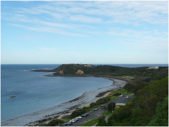
The walk along a bush path to the point at Settlement Point was worthwhile. At the lookout Elizabeth Island was starkly apparent right in front. It was easy to see how the Lady Nelson could have sheltered from the wind blowing from the northern quarter and in the channel separating it from French Island it would have been sheltered from wind coming from the south.
Looking to the right, the fellows could vaguely see the eastern tip of French Island to the north-east. The rocks and markers on Pelican Island and Snapper Rock all pointed to a dangerous area not to be taken lightly.
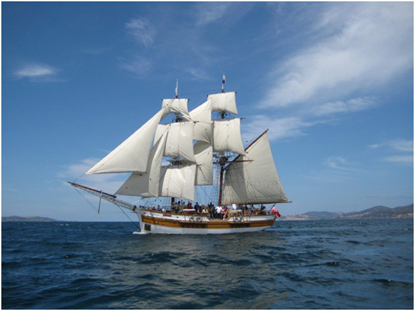
Replica of the Lady Nelson underway for a great day's sailing. FM of TSTA.
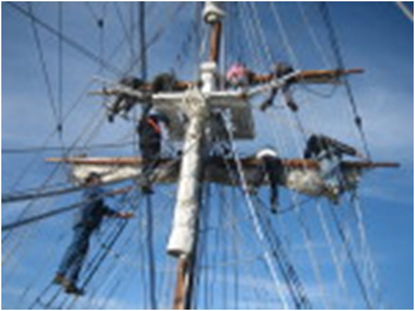
Good fun in good weather. What about in bad weather and rolling seas?. FM of TSTA.
As the guys drove around the foreshore and down to the jetty area, at Corinella the main jetty appeared to be nearly covered. Chris thought it must be a very high tide, because the lone fisherman on the jetty appeared to be nearly standing in the water.
On the way out to get food at San Remo, the fellows talked about the second settlement in Victorian history that was set up here, on 3 December 1826. The site had been chosen as a result of ill-informed advice and lack of accurate information so that the Governor of the day made a bad decision. Maybe Hastings bight would have been better. After only 14 months the ‘settlers' packed up and returned to Sydney.
A member of the settlement was William Hovel, a retired ship's captain then explorer. In 1824 he, with Hamilton Hume, left Sydney, and arrived at Corio Bay on Port Phillip. They both assumed it was Westernport, and gave a glowing report of the countryside. Back in Sydney, after studying Murray's maps of 1802 and Charles Grimes' of 1803, they realised their error. Hovel joined the settlement to correct their assumption, by carrying out short land explorations in the district, with Corinella as the base. From his account he probably even walked in and around the Frankston district.
Food at San Remo: they just made it, the fellows were starving!
Moving on in an unsuccessful attempt to find the road to Cape Woolamai, the fellows came upon two large very different objects in a backyard. They were red spheres about four metres high, with an oblong shape on top with seats, several round portholes and a small propeller and rudder out the back. They must have been ocean survival units. All the fellows thought it would be horrible inside such a craft and being flung all over the place in a big sea, but thought it would be better than being in the water trying to survive.
The sign indicating that the Phillip Island race track was near alerted Chris and Tristan. The conversation immediately switched to speed, motor bikes, cars, gear boxes, equipment that raised one side of a car when cornering ... Phill foolishly said that if the track was not being used and they could find a way in he would let the guys have a small drive. It was not to be! Most entrances were closed off with locked gates, and security people guarded the few that were open.
At the Nobbies lookout the whole western entrance of the Port and the sea panorama were splendid. Over to Flinders and Cape Schanck the outline was partially obscure. Looking towards Somers and Balnarring the water was heavily scored with many furious white lines of surf. Around Seal Island and the other rocky protuberances the water boiled and was thrust upwards and outwards into gigantic pillars of fierceness.
Chris was very firm: "I wouldn't get in that water with six lifejackets on and surrounded by boats. Besides that some very big sharks live in there." His father had done some diving in that area, so Chris knew something about it
Meanwhile Tristan had his eyes glued to the tourist binoculars. "Hey! That's a very big ship out there. It must have left Melbourne for somewhere."
"C'mon guys, it's freezing, let's push on and see if we find where Barrallier and Murray's boat overturned and they had to swim for their lives," Phill suggested.
There are several small beachy coves along the western side of French Island. The fellows explored each one as much as possible on the drive northwards. When they came to the little track to McHaffie Point, with its reef invisible beyond, they all thought that area was the most likely. Particularly when Phill recounted the true story of a yacht capsizing, resulting in loss of life.
Ventnor beach was just the spot for some skylarking and exercise for the guys, after they had spent a large part of the day cooped up in the Disco. Tristan reckoned he could see a large fish net in the distance, but it proved to be a large bunch of very green seaweeds.
Their second-last stop was Rhyll. Here the fellows inspected the monument erected to the early explorers. They thought that the reference to Baudin's French expedition could have named Brevedent, who actually rowed around French Island, or Milius, who was in command of both ship's boats. However, not a mention! The visitors conjectured about the site of a freshwater well established by a later ship's captain. It seemed awfully close to the beach-only about 20 metres-and the salt water. From that same location it was possible to see the conformation of Churchill Island.
Driving along the wooden causeway to Churchill Island, with the tide now significantly lower, the mudflats that surround and make the island were extensive. In fact crossing the small wooden bridge over a larger segment of mudflats identified the land as an island, not just a bit of higher ground in the Port.
On the way back, just short of the bridge over the Bass River at Bass, the fellows remembered fishermen with their utility giving them a wave on an earlier expedition. Why not try to find that spot? they thought. So they drove down a small track hoping to arrive at the river mouth. They took a turn that proved to be the wrong one, and found themselves in a blank spot. As the day was getting on they decided to drive on and inspect their original parking spot at Grantville, to see what effects the dropping tide would reveal.
Yes, with all the mud banks now becoming apparent this part of the Port looked as if it could become dangerous indeed. Not a place to be without modern equipment if an emergency occurred. It had been a long day, and all the fellows were weary. But the following day promised to be full of interest.
All was not going to plan the next day at HMAS Cerberus Stony Point Westernport. Access to the site for the general public is simple, but there was some delay before the museum opened.
Entering, via the Coxswains office at the entrance where the guys had to get permission to enter the base by signing in and registering the Discovery then turning left at the first street, it becomes apparent this is one of Australia's premier defence training establishments. A feeling of controlled order emanates from it.
The large formal parade ground at the side of a very extensive grassed area, surrounded by single- and two-storey buildings from the 1930s and 1940s, gives off enormous atmosphere. Small groups of seamen were marching, and individuals were going somewhere with a purpose in various uniforms: all added to the scene.
Inside the museum from the enormous dual wooden helm, pictures of people, ships, and actions, displays, models, relics created a lasting memory.
"Hey, Phill, lift this shell casing." Chris smugly pointed to one of six empty shell cases sitting on their bases, nose pointing upwards. They were brightly painted.
"Ugh! no go," was all Phill could offer after trying.
Tristan was bubbling with fun: "We think they are filled with concrete."
Unfortunately the bust of George Bass is located in the Officers Mess, so the fellows will have to write a letter to the Executive Officer of HMAS Cerberus requesting permission to see the bust.
‘ "Next stop the Gunnery site at West Head, Flinders." Tristan had taken over as tour guide. "I'll show you the surfing area near it. I've surfed there."
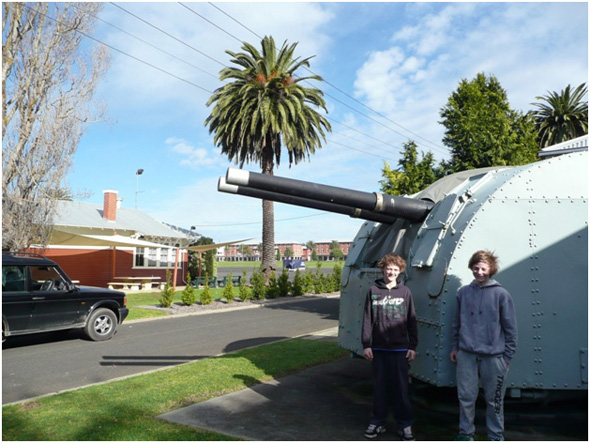
Two enthusiasts at the naval base HMAS Cerberus
From the monument to Bass and Flinders on the cliff overlooking the pier, observers have a 180-degree view of the western side of the Port, including the west coast of Phillip Island and the Nobbies with Seal Rocks and Black Rock. With the gusty wind blowing against the ebbing tide, the rows and rows of white water in the shoal banks were evident. All the fellows nodded wisely and stated that they would never have sailed in that area-it was too dangerous. Which also explains why no very early exploring was carried out in the western area.
The Gunnery site was closed. It was disappointing: the guys were half expecting to see and hear big shells being fired.
West Head, near Flinders
So the three fellows moved on to the Cape Schanck lighthouse. The ocean views, particularly that of a large container ship some kilometres offshore, could have presented an opportunity for naval gunners if the guns had been functioning. The cliffs looked quite frightening for any ship blown towards the shore. The lighthouse continues to operate as a valued aid to navigation.
The Light House Keepers museum showed the story of the light from early beginnings to modern day. On the time chart on one of the walls, the first Holden sedan rolled of the assembly line in 1948.
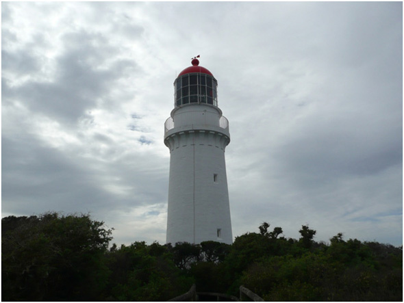
Cape Schanck lighthouse
In Sorrento at the Wooden Boat shipyard, at least 30 couta boats in various stages of repair, maintenance and storage excited the fellows' imagination, with beautiful flowing lines, bent and protruding forestay, flared bows. Imagine sailing some of the smaller ones out the Heads. The guys also discovered a pile of lead ballast ingots stacked neatly on a pallet before the bows of a particularly large couta boat. Both the guys picked a couple up but found that one was enough. The stack probably weighed about two tonnes all together. The ingots were a necessary addition to the bottom of the boat to help prevent capsizing.
The site of the first Victorian settlement at Sullivans Bay, in Port Phillip, provoked a lot of conversation, particularly as Phill asked the guys to take turns reading out aloud some of the historic facts and names.
"Look at that, there is the name of a convict who was only 12."
"Look, there is another one."
"A few ran away."
"There is one who was only a baby."
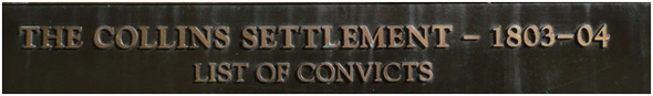
Plaque in modern-day Sorrento. MPC.
After trudging up the small hill track and reading about the runaway convict William Buckley, and not believing that the grave sites were the originals of nearly 200 years ago, the fellows found it hard to imagine that the little indent in the bay had been home to more than 300 people, even if it was for only eight months.
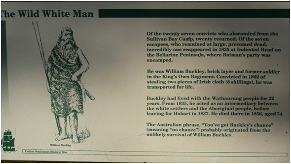
Escaped convict William Buckley. FCSS.
Fifty metres offshore from the lookout, two dolphins were lazily surfacing and diving. Phill was about to point out a black bird plunging vertically into the bay about 20 metres offshore, when he realised it was a rock that Chris had flung into the air from behind. That started a flurry of rock shying, until the rocks started to get as big as house bricks, then it had to stop.
Following a little historical plaque reading at the lookout, when the fellows retraced their steps they looked again at the historical monument.
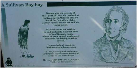
Co-founder of Melbourne John Pascoe Fawkner, son of a convict. FCSS.
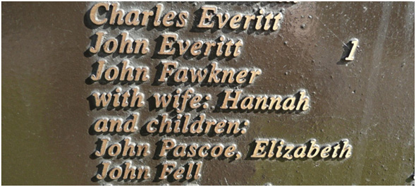
From the plaque in modern-day Sorrento listing the convicts in the settlement at Sullivans Bay. MPC.
They found the name of John Pascoe Fawkner, joint founder of the settlement of Melbourne with John Batman. Both had grown up in Tasmania, and came to Victoria to extend their sheep flocks and business interests.
Previous Chapter | Chapter Selection | Next Chapter | Download Chapter